
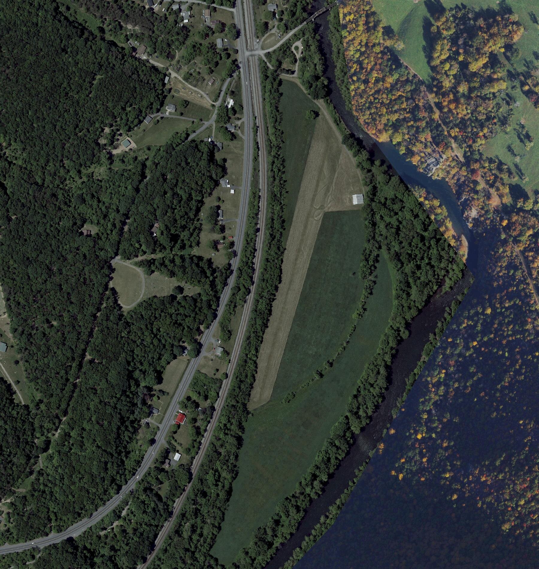
Most of the backcountry strips pilots talk about are in Idaho, Montana and the desert Southwest. One just opened about 85 nautical miles northwest of Washington, D.C. High Rock Airfield sits in a bend of the North Branch of the Potomac River in western Maryland, where the river is the line between Maryland and West Virginia. The Recreational Aviation Foundation (RAF) announced on Oct. 30 and Nov. 1 that it now owns the field, has licensed it with the FAA and the State of Maryland, and is welcoming visiting pilots. It is on the Cincinnati Sectional as 68MD.
How it came to the RAF
The field was the Armstrong family's. According to the RAF's announcement, Bob Armstrong and his father, Lt. Col. Harold Armstrong, based their vintage airplanes there, and one of their Aeronca Champ restorations won a Lindy at EAA AirVenture Oshkosh. Bob was a lifetime member of EAA, AOPA and the Aeronca Club, among others, and it was his wish that the strip be kept for other pilots. When he died in 2024 it passed to the RAF. RAF director Jeff Russell and volunteers Mike Truschel and Brian Haines did the work of getting it licensed and ready. RAF president Bill McGlynn said the foundation will "honor the Armstrong family's legacy by creating a welcoming place to enjoy the fellowship of backcountry aviation."
The strip was cut from farmland. It takes its name from an overlook that rises 1,000 feet above the runway, and the RAF lists camping near the river, swimming, picnicking and trout fishing among the reasons to go. The RAF calls it a primitive field for now. Its High Rock page lists the work planned next: a new hangar roof, campsites near the river and an outhouse.
What the FAA record shows
The FAA's airport data, effective Oct. 29, 2026 (as published by AirNav), lists:
- Runway 2/20: 1,700 by 75 feet, turf, no markings. Left traffic for both runways.
- Elevation: 756 feet. The runway 2 end is 755.5 feet and the runway 20 end 750.3 feet.
- Location: 5 miles southwest of Rawlings, Maryland.
- Use: Private use, permission required before landing. Owned by the Recreational Aviation Foundation, activated August 2026.
- CTAF: 122.9. No tower and no segmented circle.
- Weather: No weather station on the field. The nearest is the AWOS-3P at Greater Cumberland Regional (CBE), 12 nautical miles northeast, on 128.625.
- Services: None listed. There is no fuel.
Some early reports gave the runway as 1,730 feet. The FAA record and the RAF both say 1,700.
What a pilot has to do before going
"Private use" means what it says. The RAF requires each pilot to review and acknowledge its current safety briefing before arrival. The briefing is in the RAF's free Airfield Guide, which needs an account, and the RAF keeps the electronic record. It is updated every year and is good only for the pilot who acknowledged it, so a pilot bringing a friend in a second airplane needs the friend to do it too. Hangar Debrief has not read the briefing itself, which is behind the sign-in, so what it says about approaches, obstacles and the river isn't covered here.
The RAF's page sets two more rules: High Rock is for recreation, not training, and no touch-and-goes. Pilots are asked to land, get out, and stay a while.
For any flight, 14 CFR 91.103(b) requires the pilot in command to know the runway lengths at the airports of intended use and the airplane's takeoff and landing distances. For an airplane without approved flight manual data, the rule calls for "other reliable information" for the expected elevation, runway slope, weight, wind and temperature. At High Rock the facts to work from are a 1,700-foot turf runway with no markings and an overlook 1,000 feet above it. The airplane's own figures for grass, at its weight and the day's temperature, settle whether it belongs there.
Sources: Recreational Aviation Foundation, "Gem of the East: High Rock Airfield in Maryland Expands the Map," Carmine Mowbray, submitted Nov. 1, 2026; RAF, "Featured Airstrip: High Rock, MD," submitted Oct. 30, 2026; RAF, High Rock, MD airstrip page; AirNav, 68MD High Rock Airfield, FAA information effective Oct. 29, 2026; 14 CFR 91.103, Preflight action (Cornell LII); AvBrief, "RAF Given Maryland Backcountry Strip" (the pointer to the story).
Photo: U.S. Department of Agriculture, National Agriculture Imagery Program, image m_3907833_nw_18_030_20230525 of May 25, 2023, through the USGS National Map's NAIP imagery service; a U.S. Government work in the public domain. Centered on the FAA's position for 68MD, 39.4742 N, 78.9427 W.