
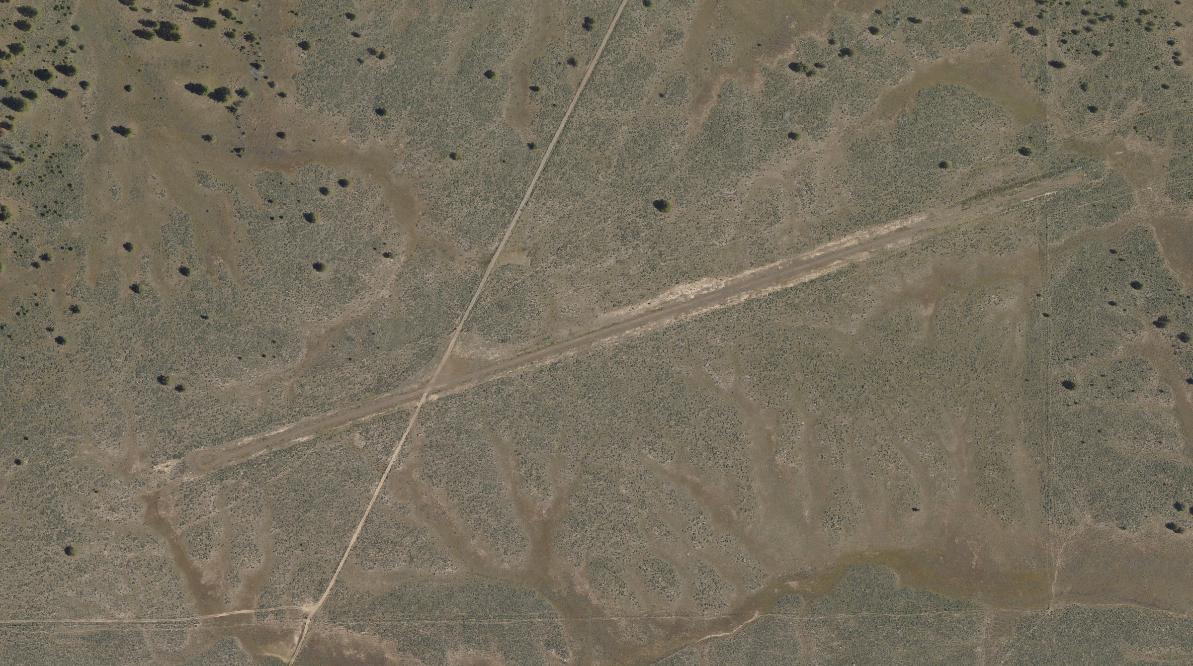
Rager is a gravel strip in the Ochoco National Forest, at the old Rager Guard Station in the Paulina Ranger District of central Oregon. The Forest Service moved the station's offices to Prineville in 2013, and with no one on site the strip went to brush, rodent and cattle damage and lost its windsock. Since 2020, volunteers with the Recreational Aviation Foundation (RAF) have worked with the Forest Service to bring it back and keep it up. The RAF reported on Nov. 12 that a crew had gone back in early November.
The work
According to the RAF's report, eight volunteers from Central Oregon met at the strip in early-winter weather. Five flew in. The others drove two and a half hours, towing their own mowing and grading equipment. They:
- cleared overgrown brush from the runway, the aircraft parking area and the camping area;
- mowed and leveled the gravel runway;
- restored a weathered picnic table;
- repainted the runway markers;
- put up new signs.
RAF Oregon Liaison Richard Mayes reported the work. Paulina District Ranger Robbie Piehl thanked the crew, and, the RAF writes, "the District Ranger has asked that RAF investigate what may be required to reopen two other long-neglected airfields." The report doesn't name them or give a timeline.
How the strip got here
The runway dates from the 1930s, and the guard station's historic buildings were built by the Civilian Conservation Corps. The RAF's earlier reports trace the work since:
- 2020: An RAF grant paid for equipment and material. By May, volunteers had cleared brush from the strip, the turnarounds, the parking area and a six-foot swath on each side, repaired the surface, put up a windsock and built a stone fire ring beside a donated picnic table. That report gives the strip as 2,800 feet long and 25 feet wide.
- 2022: A July work day repeated the brush clearing and surface repair and gathered what was needed for a current report to the Forest Service.
- 2023: Volunteers mowed the strip, the turnarounds and the parking area, leaving the runway clear for a width of about 50 feet, and replaced the windsock.
- 2024: While fighting a nearby wildfire, the Forest Service graded and profiled the gravel with heavy equipment. Mayes said then that the work made the strip "suitable for use by a wider variety of aircraft and pilot capabilities." Under the agreement, the RAF supplies the windsock, picnic table and fire ring and its volunteers keep up the strip and campsite; the Forest Service handles noxious weeds and livestock.
What isn't known
None of the RAF's reports gives an FAA identifier for Rager, its elevation or a procedure for asking permission to land, and Hangar Debrief didn't confirm any of them. OurAirports, a volunteer-kept airport list, shows the strip with no identifier and marks it closed, which the RAF's account of a maintained, visited strip doesn't bear out. The RAF's Airfield Guide has an entry for Rager, open to pilots who sign in. The Forest Service's Paulina Ranger District manages the land.
14 CFR 91.103 requires the pilot in command to become familiar with all available information before a flight, including runway lengths and the airplane's takeoff and landing distances. For Rager, what the RAF has published is a 2,800-foot gravel runway, cleared about 50 feet wide, in open country where wildlife and livestock have damaged the surface before. The surface after this fall's leveling, and the snow on it this winter, are for a pilot to find out before going.
Sources: All read Nov. 20, 2026. Recreational Aviation Foundation, "Volunteers Work to Keep Oregon's Popular Rager Airstrip Safe," Nov. 12, 2026; RAF, "RAF Grants Funds for Rager Creek Airstrip Safety Improvements," March 31, 2020; RAF, "Oregon's Rager Airstrip Improvements," May 27, 2020; RAF, "Maintenance Continues at Two Oregon USFS Airstrips," July 9, 2022; RAF, "RAF Volunteers Maintain Rager Airstrip in Oregon," May 23, 2023; RAF, "Safety at Oregon's Rager Airstrip Boosted by USFS-RAF Cooperation," Sept. 16, 2024; OurAirports, airports data file, entry US-8336, Rager Airstrip; 14 CFR 91.103, Preflight action (Cornell LII); General Aviation News, Nov. 18, 2026 (the pointer).
Photo: U.S. Department of Agriculture, National Agriculture Imagery Program, image m_4411950_ne_11_030_20220626 of June 26, 2022, through the USGS National Map's NAIP imagery service; a U.S. Government work in the public domain. Centered on the strip as it shows in the image, at about 44.223 N, 119.763 W, the position OurAirports gives for Rager.